Navigieren auf STI Bus AG
Sprunglinks
Suchbox
Hauptnavigation

Bussalp via Bort to Unterer Lauchbühl


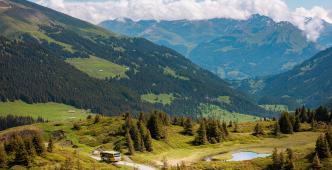
The three-hour hike offers plenty of variety. This includes not only the marvellous views of the four-thousand-metre peaks of the Bernese Oberland. Flowery mountain meadows and sparse woodlands as well as unspoilt moorland and bubbling streams are also part of this hike.
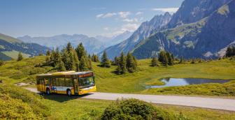
Already the starting point invites you to linger. Bussalp is a place where you can really letting your mind wander. At almost 1,800 metres above sea level, the view sweeps over the imposing peaks of Eiger, Mönch and Jungfrau as well as the alpine meadows with their colourful flowers. A path leads across the pastures and Büössalpbach stream down to Holzmatten at 1,690 metres above sea level. On the following section of dirt track, you walk through sparse woodland towards Rasthysi. The high mountain peaks, such as Schreckhorn, come into view time and again. Rasthysi (rasten = to rest) lives up to its name, as it has a small self-service restaurant.
The route then follows «Höhenweg 1600» on a paved road to Holewang. After a few minutes' walk, wooden benches at a wonderful view point invite you to linger and enjoy the view. The route runs through sparse sections of forest with fairytale-like spots and across meadows towards Bort. After Milibach, another ascent awaits, but the nearby middle station of Firstbahn tempts you to take a break. The walk takes around 10 minutes. In addition to a restaurant and picnic facilities, the site offers a great playground for children of all ages.
Well rested, we return to Milibach. From there, the hiking route leads shortly uphill before the path branches off onto narrow meadow paths to Unterer Lauchbühl. The descent is just as steep as the ascent and continues on a well-surfaced road to the next forest section. The route on the forest path is an up and down. Once the Bärgelbach stream has been reached and crossed, the final descent to the destination of the hike and the bus stop of the same name awaits: Unterer Lauchbühl.
Overview plan summer

Bussalp mountain restaurant
The cosy mountain restaurant on Bussalp invites you to linger and relax. Treat yourself with culinary delights from the kitchen and enjoy the unique view of Eiger, Mönch and Jungfrau.
Rasthysi mountain restaurant
A small pub as a welcome resting place on the hiking trail. Culinary delights include a "Chäs-Brätel" (slice of bread with melted raclette cheese), regional dishes, dried meat and alpine cheese. The pub is known for its ten speciality coffees.
Your host Rolf Schneller is looking forward to welcoming you. Groups of up to 30 people are possible upon reservation.
Alternatively, GrindelwaldBus will take you directly to the bus stop of the same name in just over 30 minutes.
Prices
Line 126, Grindelwald – Bussalp (mountain line) /summer
Timetable
You can find the timetable for line 126 in the timetables.
Search for a connection
Directly plan your journey at the start of the offer.
Arrival journey
 to Bussalp from Grindelwald, Unterer Lauchbühl
Further information
Find more information about the journey here (hiking map, altitude profile and/or a video).

Erklärungstext zu Höhenprofil
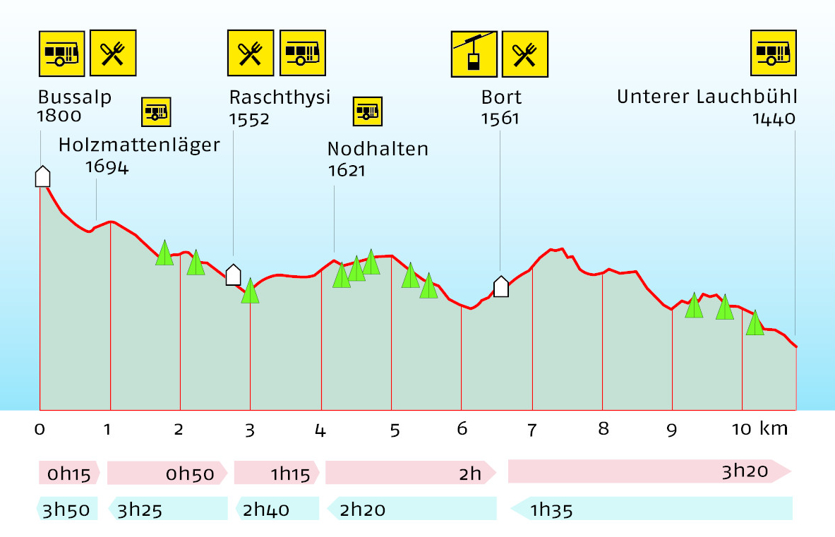
The hike starts on Bussalp at 1,800 metres above sea level. There is a refreshment stop on Bussalp. This is the highest point of the hike. The path leads down to Holzmattenläger at 1,694 metres above sea level. About 1 kilometre of the 10.8-kilometre route is already completed here. A walking time of 15 minutes is to be expected. It is possible to continue your journey with GrindelwaldBus. The path leads down to Raschthysi at 1552 metres above sea level. There is a refreshment stop here. The route is almost 3 kilometres long and takes 50 minutes to walk. It is possible to continue your journey with GrindelwaldBus. The route goes then gently uphill to Nodhalten at 1,621 metres above sea level. The route is about 4 kilome-tres long and takes an hour and 15 minutes to walk. It is possible to continue your journey with GrindelwaldBus.
Plan and organise your journey
Have the entire hike compiled as a PDF or download the GPS file.
Our tip: Open the GPS file conveniently on the go with the hiking planner app from the Bernese hiking trails.
Share the journey with your friends.