Navigieren auf STI Bus AG
Sprunglinks
Suchbox
Hauptnavigation

Grosse Scheidegg via First to Waldspitz


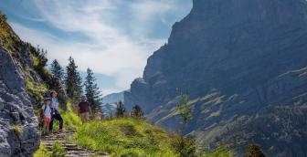
The starting point for this hike is Grosse Scheidegg. There is plenty to discover on the panoramic mountain hiking trail to the first waypoint: Wild mountain streams, beautiful flowers such as the gentian and, of course, the shy marmots. The route then leads from First to Bachalpsee. The path down to Bachläger is a little rough at times. From there to Waldspitz it's time to relax your legs again.
The rugged rock faces of Wetterhorn at the starting point of this hike are impressive to behold. But Grosse Scheidegg has more to offer than just the view of a rock face. Numerous peaks tower into the sky all around. To the west Wetterhorn, Schreckhorn, Eiger and Mönch, to the east Grindelgrad and Wetterhorn. Enjoying the view, it's an easy march along the well-maintained road towards Gratschärem. There, the signpost points to the marmot mountain hiking trail. On this section of the trail, you have to cross small footbridges over streams again and again. At Grindel-Oberlägeri, the first whistles of the marmots can be heard. On the trail named after them, the shy but curious rodents can be observed from a safe distance. After the marmot excursion, a short ascent to the First mountain station awaits. There you can enjoy a little refreshment and a truly magnificent view of Eiger and its fellows in the mountain restaurant. From the mountain station there are a few metres of altitude to conquer. A well-maintained marl road leads towards Faulhorn to Bachalpsee – a true pearl of nature. It is enchanting how the surrounding mountain peaks and the sky are reflected in it.
Passing the lake, the trail descends along the
Milibach stream on the other side of the valley. The mountain hiking trail is
narrow in places and challenges the leg muscles. At the waterfall in Bachläger,
the wet element once again shows its thunderous power. From there it's time to
relax your legs. It's a leisurely walk to the destination of the hike,
Waldspitz with the restaurant of the same name.
Tip for families
The
entire hike is often too long and too strenuous for children. Start with
children at Grosse Scheidegg and end the hike at the First mountain station.
This route is just under 7 kilometres long and takes about 2.5 hours. Firstbahn
takes you to the valley station in Grindelwald. GrindelwaldBus will then take
you safely back to the railway station or your starting point
Overview plan summer

Grosse Scheidegg mountain restaurant
The Grosse Scheidegg mountain restaurant will delight you with its panoramic views. It is the ideal starting point for family, hiking, business and club excursions. Indulge yourself in the mountain restaurant in the heart of the Bernese Oberland mountains.
Waldspitz restaurant
Waldspitz restaurant welcomes you with a wonderful panoramic terrace and plenty of food and drink.
Prices
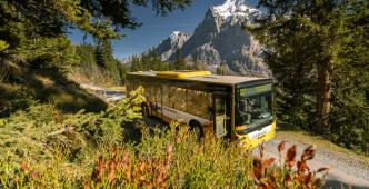
Line 127, Grindelwald – Waldspitz (mountain line)
Line 128, Grindelwald – Grosse Scheidegg – Schwarzwaldalp (mountain line)
Timetable
You can find the timetable for lines 127 and 128 in the timetables.
Search for a connection
Directly plan your journey at the start of the offer.
Arrival journey
 to Grosse Scheidegg
 from Waldspitz
Further information
Find more information about the journey here (hiking map, altitude profile and/or a video).

Erklärungstext zu Höhenprofil
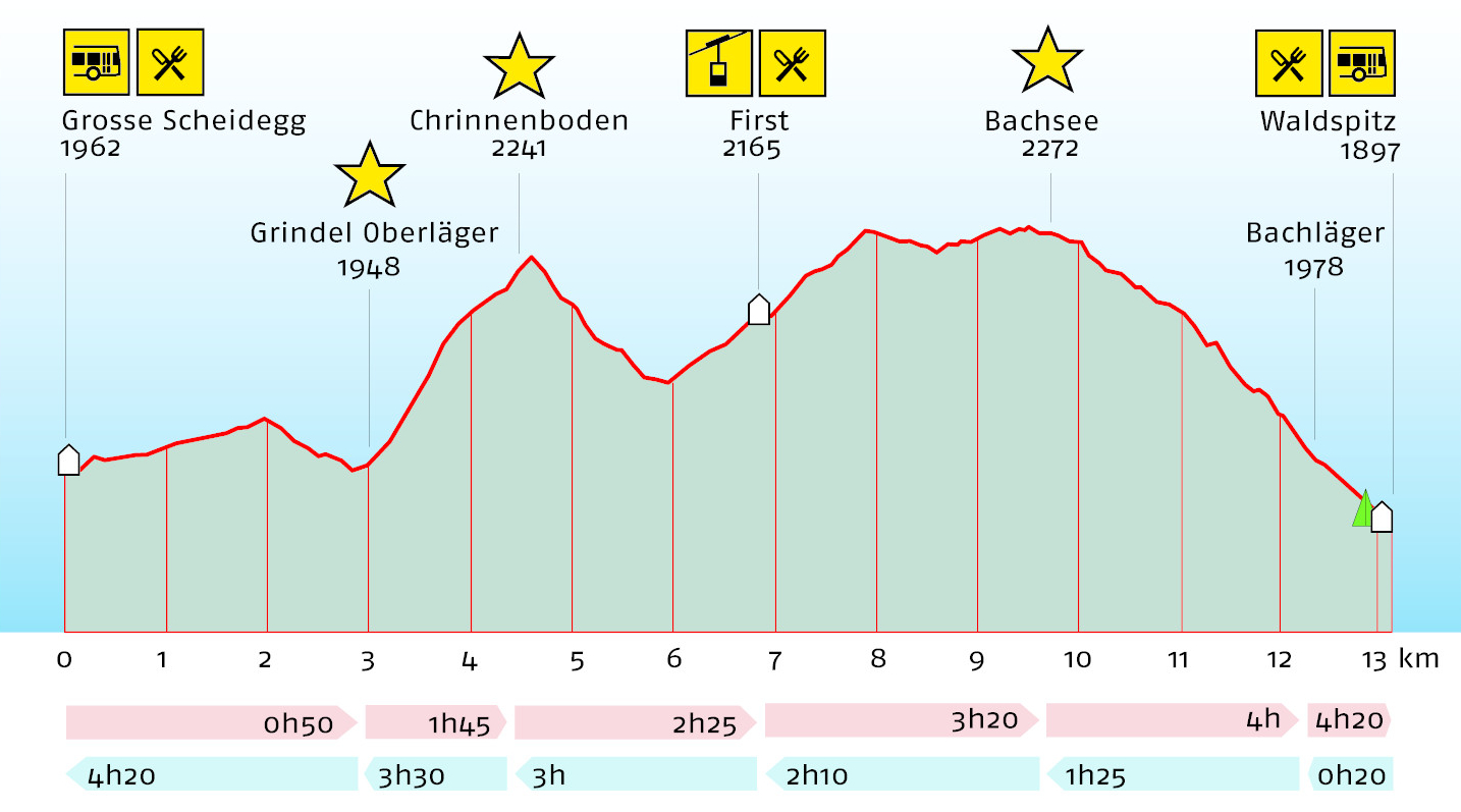
The hike starts at Grosse Scheidegg at 1,962 metres above sea level. There is a refreshment stop at Grosse Scheidegg. The trail first climbs gently and then descends to the first highlight, Grindel Oberläger, at 1,948 metres above sea level. 3 kilometres of the 13.1-kilometre route are already completed here. A walking time of 50 minutes is to be expected. The route goes then gently uphill to the second highlight, Chrinnenboden, at 2,241 metres above sea level. The route is almost 4.5 kilometres long and takes an hour and 45 minutes to walk. The path leads first down and then up again to First at 2,165 metres above sea level. There is a refreshment stop here. It is possible to continue your journey with the gondola. The route is almost 7 kilometres long and takes two hours and 25 minutes to walk. The route continues over the highest point of the hike and on to the third and final highlight, Bachsee, at 2,272 metres above sea level. The route is almost 10 kilometres long and takes three hours and 20 minutes to walk.
Plan and organise your journey
Have the entire hike compiled as a PDF or download the GPS file.
Our tip: Open the GPS file conveniently on the go with the hiking planner app from the Bernese hiking trails.
Share the journey with your friends.